


The Ohio River was expected to crest overnight at its highest point here in just over a half century, though it came short of expectations of being the biggest flood here since the big one in 1937.
The Ohio was forecast to crest at 47.70 feet at the river gauge in downtown Evansville at 1 a.m. Sunday morning, according to NOAA’s National Water Prediction Service website. That would make this the seventh-highest crest on record.
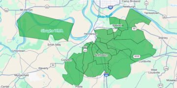
Heavy rains a week ago sent the Ohio and Green rivers rising out of their banks, with widespread flooding in the Beals-Reed area in northeastern Henderson, where multiple homes and other buildings have been surrounded or reported to be inundated by floodwater.
There are also thousands of acres of fields under water around the U.S. 41 Twin Bridges and Horseshoe Bend in the north-central section of the county and in the Geneva and Alzey Bottoms in western Henderson County, among other places.
The Ohio is forecast to begin falling in earnest by the middle of this week, falling below the official flood stage of 42 feet by mid-day Friday.
The Ohio had at one point been forecast to rise to 48.50 feet, which would have been the highest crest since the disastrous Flood of 1937.
As it turned out, the actual crest is the highest since a flood in March 1964, 51 years ago.
Based on the forecast Saturday night, here, according to National Weather Service records, are the 10 highest crests on the Ohio River at the Evansville gauge, which historically has been used to measure flooding at Henderson:
1. 53.75 ft on 01-31-1937
2. 48.82 ft on 02-19-1884
3. 48.60 ft on 02-19-1883
4. 48.40 ft on 04-05-1913
5. 48.28 ft on 03-11-1945
6. 47.72 ft on 03-16-1964
7. 47.70 ft on 04-12-2025
8. 47.52 ft on 03-10-1997
9. 46.87 ft on 03-01-2018
10. 46.78 ft on 05-05-2011

