


With lots of snow on the way and the addition of below freezing temperatures, a National weather Service meteorologist described the conditions forecasted this weekend as “life threatening.”
“Take this storm seriously,” said Justin Gibbs of the NWS in Paducah. “Don’t get caught out in this. Don’t underestimate this. We really think it’s the real deal.”
NWS say anywhere from 8 to 13 inches will hit Henderson.
If the snowfall is well below that, for example three inches, Justin Gibbs, NWS meteorologist, said, “I would be stunned if it did that.”

Eight to 13 is “the general idea right now, which is obviously a whole lot,” Gibbs said.
He said Thursday afternoon forecasts show that Henderson has a 90-95% chance of getting more than four inches.
But there’s also the possibility that the forecast misses high and the Henderson area gets 15-16 inches, he said.
“It wouldn’t surprise me from where I’m sitting today,” Gibbs said Thursday.
Whatever the result, Gibbs said the accumulation will be impactful.
And the impact will be felt throughout the next week, when forecasts show that the temperatures will not reach above freezing, leaving snowpack on the ground, Gibbs said.
That will leave snow clearing up to crews because nature won’t be able to do it and travel conditions will be dangerous, he said.
According to the NWS website, the winter storm warning is in effect from midnight Friday to about 6 p.m. Sunday. There’s also a chance of sleet and freezing rain mixed in, said the forecast. And wind chills are expected to fall to 0 degrees, Gibbs said.
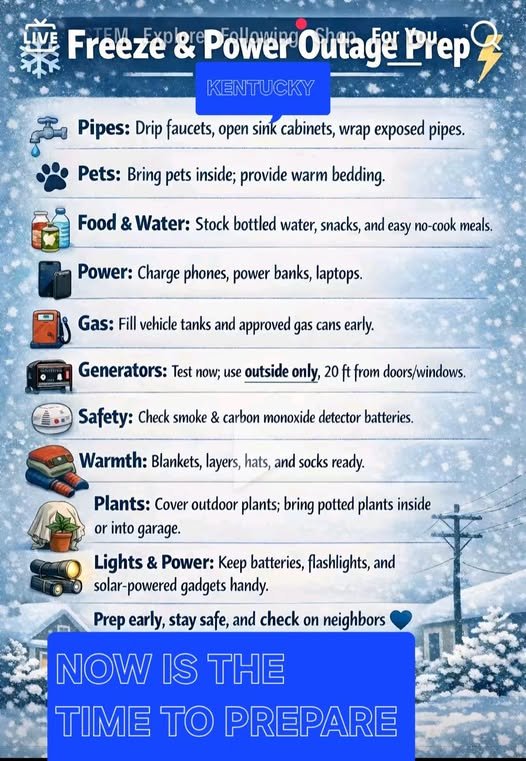
A Wednesday post from the Henderson County Emergency Management page said now is the time to get prepared.
“If you have a generator, get some extra fuel, remember safety tips on using surface heaters and generators indoors, and especially candles (never leave lighted candles unattended),” it said.
EMA also posted a freeze preparation list that we’ll also embed in this article below.
Meanwhile, Henderson City Manager Dylan Ward said that city’s trucks are ready to plow over the weekend. He said city staff would be having a meeting Friday morning to plan for the weekend. Henderson County Judge-Executive Brad Schneider also said the county’s equipment is ready to go to work this weekend.
The Kentucky Transportation Cabinet sent out a press release Thursday stating the preparation work the state is taking on in advance of the predicted storm. The work includes:
- Road crews pretreating roadways across districts, as conditions allow.
- KYTC communicating with partner agencies regarding potential resource requests.
- KYTC Division of Equipment is actively taking inventory of resources, including heavy equipment, to make sure they’re ready and available.
- All highway districts actively preparing equipment.
- KYTC communicating and coordinating with the Tennessee Department of Transportation in case either state should experience closures of interstate corridors in order to place messages on overhead message signs alerting the travelling public.
- KYTC maintaining most roads, streets and bridges that are part of the state highway system, including interstates, parkways and U.S. route designations. The cabinet operates on a four-tier priority system to keep people and commerce moving in the most effective way possible.

