Emergency officials are warning Henderson residents about a forecast the next several days that could first bring tornadoes and heavy winds and then be followed by three days of historic rainfall and equally historic flooding.
“It’s the kind of flood that when people talk about ‘the flood’ this would be the event,” said Justin Gibbs, a meteorologist from the National Weather Service in Paducah.
Gibbs called flash flooding that could occur from the rainfall potentially “catastrophic.”
When asked if NWS uses the word “catastrophic” often to describe weather, he said no.
“We reserve that for situations like this one,” Gibbs said.
The first round of severe weather is forecast for Wednesday evening, with the possibility of tornadoes and damaging winds starting in the evening at about 5 p.m.–6 p.m. and lasting until 10 p.m.-11 p.m., Gibbs said.
He said tornadoes, if they occur, won’t travel long ranges but could develop rapidly and be intense.
After Wednesday, large storms will occur daily for the next three days, said Tim Troutman who is with the Henderson County Office of Emergency Management. In total, the rainfall across the span of the storms will dump 10-15 inches of rain locally, Troutman said.
To put that into perspective, he said that the area averages about 42 inches of rain yearly; in three days, Henderson could get ¼ of what it normally gets in a year, Troutman said.
The only other rain event in the past 100 years in Henderson, Troutman said, occurred from Jan. 6-24, 1937, which also is the time of Henderson’s great flood.
According to the Historical Marker Database:
“The Ohio River Valley’s worst flood occurred in January-February 1937. Three weeks of continuous rain, sleet and snow dropped 21 inches of precipitation during this period. The Ohio River reached its crest in Henderson on February 1, 1937, at the level of 53.9 feet.”
Gibbs said NWS is forecasting the river reaching 38 feet, but he said NWS doesn’t forecast river levels more than a few days out. It’s a “very good bet” that the Ohio River will go higher than 38 feet, he said.
Flash flooding, though, could potentially be more damaging than rising levels of the Ohio, especially in the first few days.
“This carries the potential for it to be a very dangerous flash flood event,” Troutman said.
He added that the weather over the course of the next several days could cause emergency officials to issue flash flood emergencies, which means that significant life-threatening flooding is imminent or already occurring.
As a reference, Troutman said that there were many flash flood emergencies issued during the flooding in eastern Kentucky that occurred in 2022. According to an article from the Kentucky Lantern, 16 inches of rain fell in eastern Kentucky in summer of 2022 and at least 43 people died during that event.
Troutman advised residents to clear drainage areas, move sensitive property out of low-lying areas, and be ready to move to higher ground in a moment’s notice during the next few days.
“The important thing as we move into the event is to keep a really close watch on the situation,” he said.
Troutman advised people to have more than one method of receiving weather warnings. That could include a weather radio, local TV or local radio as well as warning apps on cell phones. He also said that residents can sign up for the office of emergency management’s Hyper-Reach public alert system here: Hyper-Reach Public Alerting | Henderson County, KY
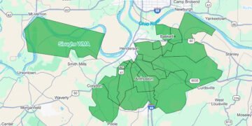
He also said that flash flooding would probably occur in regularly occurring flood areas in the county, such as the Spottsville, Reed, Geneva and Smith Mills areas, as well as on city roads. He mentioned in particular Green Street.
He said only six to 12 inches of water on a roadway can lift up a vehicle and carry it away. He said motorists should heed the common motto when encountering high water: Turn around, don’t drown.
Troutman repeated that the next several days’ weather could be one of the worst heavy rain events that has affected the area for decades.
“It’s just incredible—the setup that is in play—that we’re preparing for,” he said. “This is going to be a significant event. We definitely need to be prepared for potentially the worst. We should be prepared for the worst and hope for the best. Now’s the time to do what you need to do and come up with a plan.”


